TONY MAK
Landscapes Along The Waterways
From Macao To Guangzhou
(west passage)
澳門至廣州水途即景
(內河)


Map of Waterways between Canton and Macao
廣州至澳門水道圖
1817


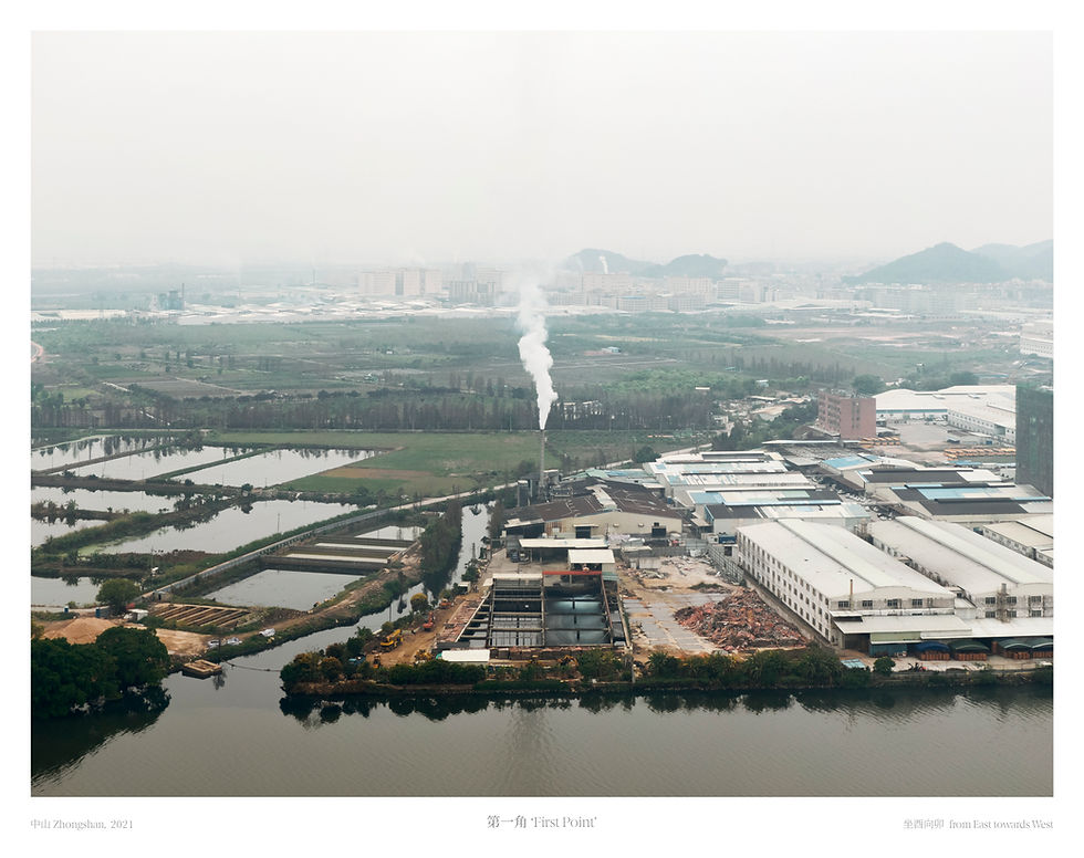


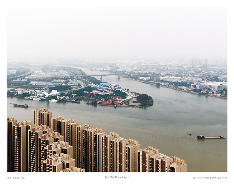


兩百年前,廣州曾是中國唯一的通商口岸,而澳門也曾是唯一一個允許有外國人居住的地方。二十世紀前,由於珠江三角洲河流密佈,陸路不便,來往廣州與澳門主要靠水路。來往兩地曾有兩條水運航道。內河航道從內港向西出發,取路西江入石岐河進入香山縣城,途徑順德縣城、紫坭關、碧江、大王滘進入珠江後航道(外商亦稱之為’澳門水道’)抵達省城廣州,沿途水道彎彎曲曲。外河航道向東經伶仃洋,從虎門入獅子洋,再至黃埔港下碇後經珠江進入廣州城。這兩條航路便承載著鴉片戰爭前閉關的中國的所有對外交流。
內河航道全長約160公里,多為本地居民運交通使用,外商貨運一般取外河。因內河途徑香山、順德等煙火旺盛的縣城,十九世紀的外商視此航道為深入了解南方風土人情的遊覽線路。他們留下了的文字與畫作如今成為了研究本土歷史文化的珍貴資料。如今由於已經無法承載大噸位船隻,陸路交通也逐漸發達,內河航道已經逐漸被棄用。
2020-2022年間,我遊走廣州與澳門的水道之間,根據鴉片戰爭前的舊河道圖,尋找出每個哨點以及沿河市鎮,用無人機拍攝紀錄河道風景。作鄉土風景勘測以及紀錄用途。
Two hundred years ago, Guangzhou (Canton) was the only opened port in China, and Macao was the only place that foreigners were allowed to reside. Before the 20th century, commuting between Macao and Guangzhou was heavily relied on waterborne transport, as the dense river networks in the Pearl River delta made land transport inconvenient at that time. There were two main waterways between two places, the inner passage started from the Inner Harbour in Macao, took the westward way into the West River and entering the Shiqi River toward the Xiangshan County; therefrom took the zigzag waterway passing through Shunde, Zini(Purple Mud) Custom, Bijiang, Dawagjiao(The Great King Channel) and arriving at the city of Guangzhou through the back waterway of the Pearl River (also known as Macao Passage by foreign merchants). The outer passage, on the other hand, started eastward toward the Lintin Sea (the Solitary Sea), entering the Lion Sea through Humen (Bogue); thereafter anchoring at the Whampoa Anchorage for custom inspections before entering the city of Guangzhou. These waterways therefore once carried the responsibility for all the foreign communications of a closed China before the Opium War.
The west passage, measuring around 160 km in total, mostly used by local residents, foreign merchants generally used the east passage for logistic purpose instead. Yet they also saw the west passage as a perfect touristic route to take a glimpse of the view of Southern China countryside, as it ran through populated counties like Xiangshan and Shunde. Some of the travellers in the 19th century sketched and wrote about their trip and left some precious historic records for local culture and history study. In modern days, the west passage has gradually abandoned, as its incapacity for large tonnage ships and the development of bridges and land transports such as highways and high-speed railways.
During 2020-2022, I travelled along the waterways between Macao and Guangzhou with an ancient river map to locate each outposts before the Opium War, and used a drone to capture the current landscape of the waterways.